

Its been a long time since I wrote about some extra-ordinary canyoning experiences. Changes in personal and professional life are taking its tool and canyoning joy is pushed to the side. But I haven’t gave up on it, don’t worry. There is so many more canyons on my to-do list.
The story that you are about to read, should be kept secret. At least that was what we agreed when we did first descent of Albanian canyon Zhepe. To be frank, it was not our finding. Sandi (Canyon Dave) saw the post on the Facebook that there is a prospect of great big canyon at the south of Albania just next to the Greece border near Leskovik identified by Olo Dobrzanski (v7a7.pl). And we decided to secretly give it a go since we were in the area. One day we were asked about Zhepe. We like to keep secrets, but we dont lie so it is time to reveal our story and inspire somebody else to do Zhepe.
Preparations for descent started. We were not sure if we had enought gear to equip all the anchors, since brought 20 bolts and anchorplates. We had two powerdrills and 2 spare batteries. And about 200 m of rope + about 20 m of old rope for improvised anchorpoints. We anticipated it would be enough. Camera had to stay in the car, because the days when I was superhuman who could carry 40+ kgs of gear had long passed. After you turn 35, every gram counts. What bothered us was that the day would be long. By observing the satellite images we haven’t spoted any trail that would lead us to the canyon on the left bank. So the only doable option seemd hiking to the pletau below Kourouna Koupouva mountain at 1728m and then descent for 800 meters to estimated start of the canyon. Since we were »two-men canyoning expedition« with two-women support team, we decided to hike to the top of the mountain on the previous afternoon and camp there. In the morning we would part, girls would hike back to the car and carry down the sleeping bags and tarps which we used to protect us from dew. Its has been an all-star accomodation on the Greek side of the border with a cheap price tag. Price for this commodity was paid by our backs that carried all the gear up the mountain.
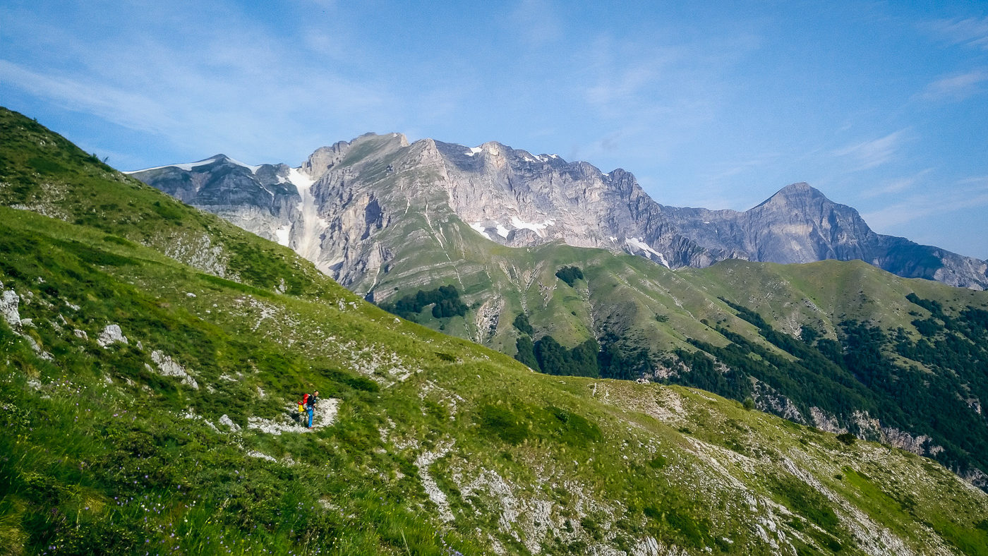
In the morning we left our cosy base camp, huged and kissed our better halfs and started the steep descent into the canyon. Below Maja Fanjas mountain we saw a few waterfalls. It was way above the location where we wanted to start. Sandi excitedly shouted: »We found a monster canyon«. But the fact that there is so many waterfals was also worrisome. It ment that we wouldn’t have even remotely enought bolts to equip all the waterfals. We descented into the canyon carefully, avoiding abseiling so we could hike back in case canyon would be really a monster from the start. But the more we descended, the more sure I was, that I wouldn’t climb back to the steep mountain with all the gear on my back. I wondered how much would cost to get a heli ride back and how many countries we would have to involve in such lazy-man rescue operation. The lower we got, more commited we were, that we will enter it, regardless of how scarry will it look.
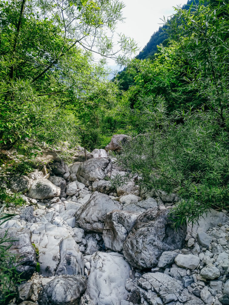
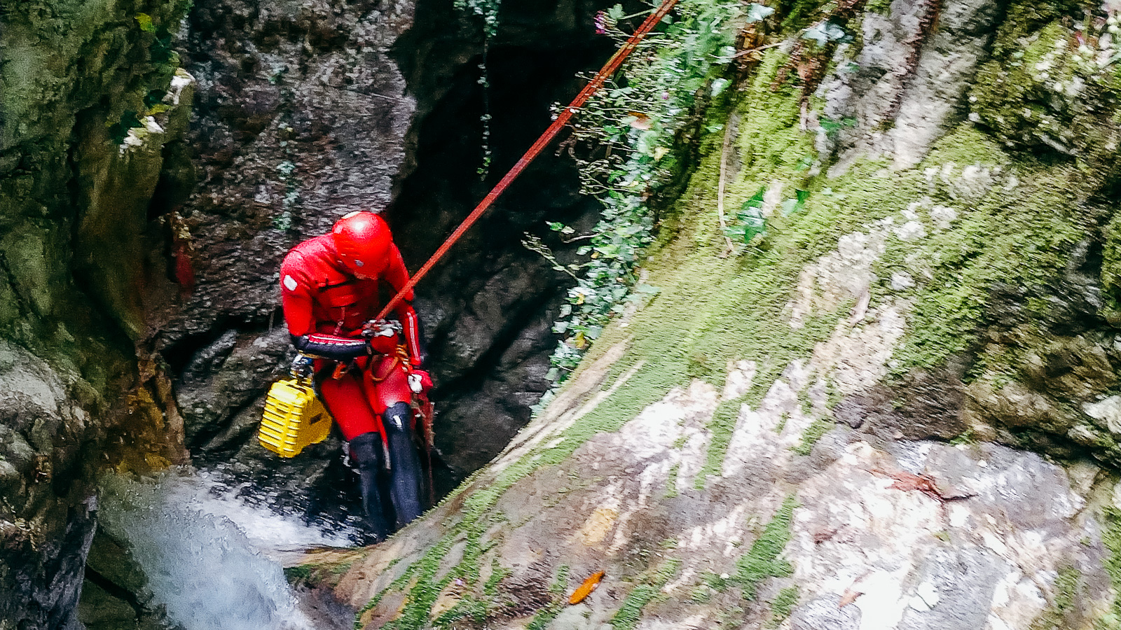
After about an hour and a half of bushbashing we reached the canyon. It didnt even remotely looked like a monster canyon. Riverbed was dry and about 3m wide. We concluded to give it a go, but we decided to avoid drilling anchorpoints when not absolutly necessary. So stucked wood and rocks were our friends, we mostly cut old rope and build anchors with it. Steel pitons, legacy of my grandfather, also came in quite handy. They are fast and efective for expedition style canyoning in limestone. But you have to have the right rock, right crack and right shape of piton. And if the piton »sings« when you hammer it in, you are doing the right job. This is at least how was I tought as a kid.
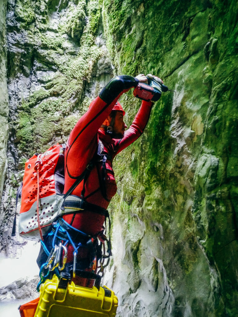
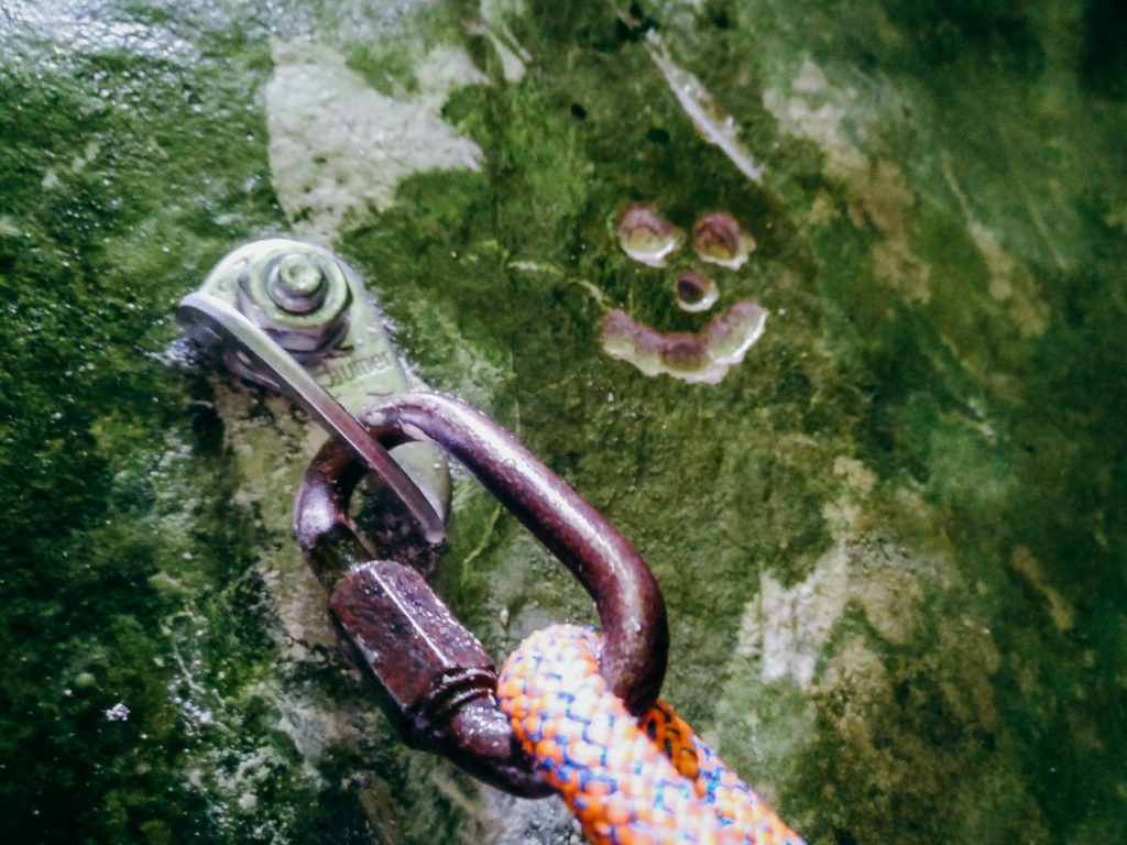
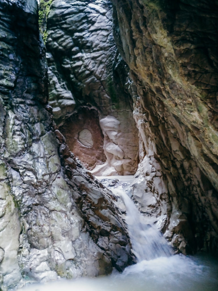
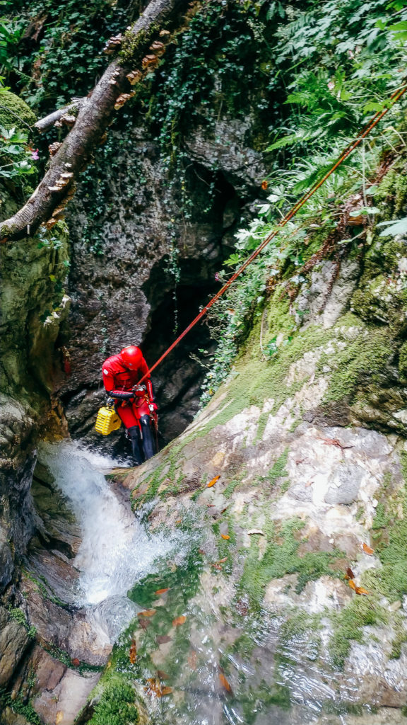
About half an hour in the walls were getting steeper and the canyon got the right shape. When we reached to the first real waterfall, which we connected with second one (about 30m) we were really happy. Canyon looked promissing. Sandi used powerdrill to scuplture out the smiley face in the rock above anchorpoint. It was our way of saying hello to forthcoming visitors. And so much for sparing batteries! 🙂
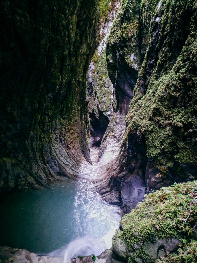
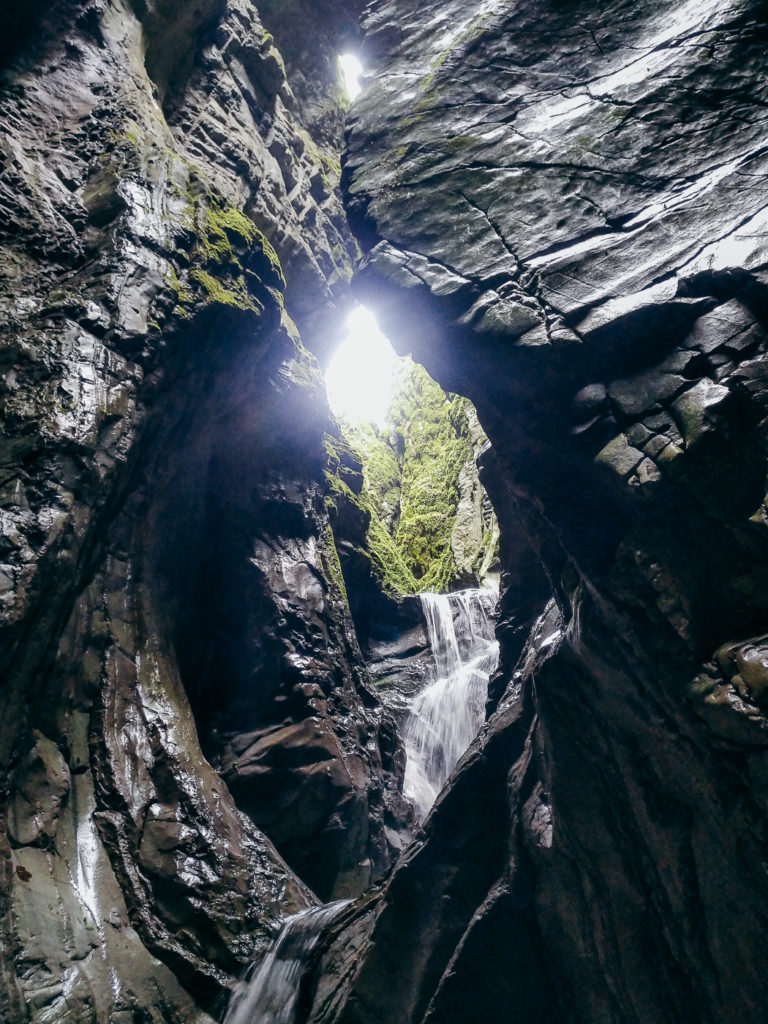
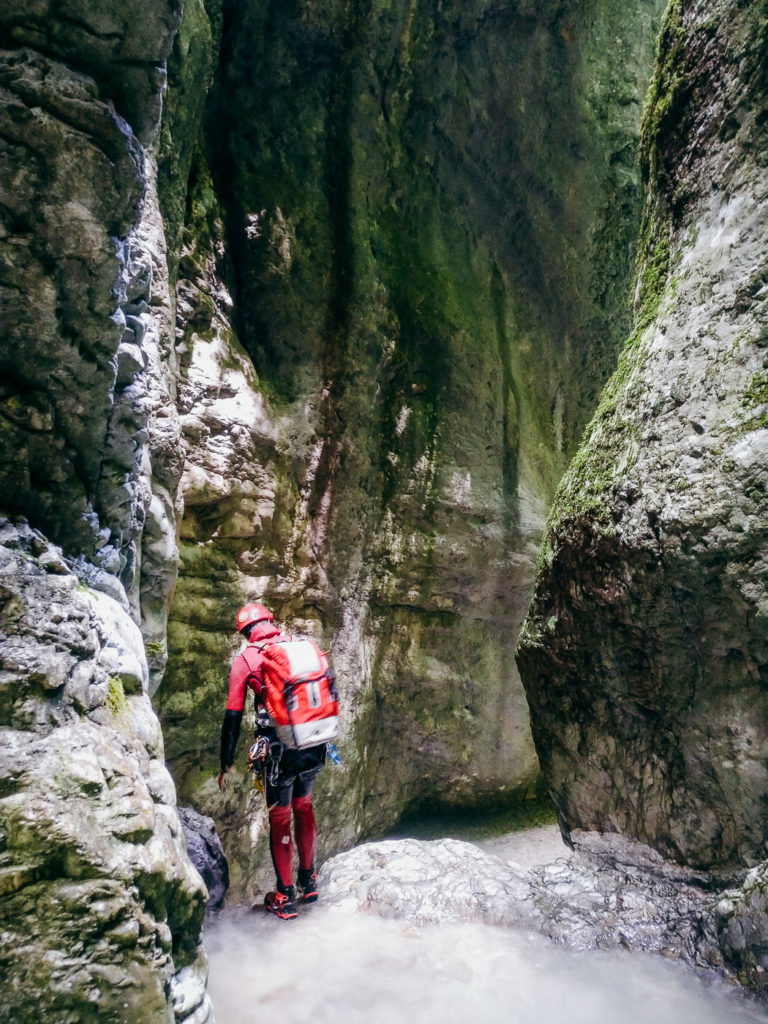
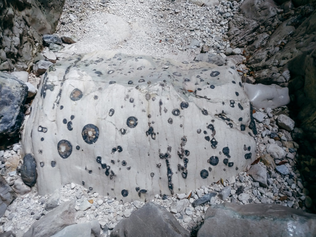
When canyon completely closed up, there were sky high walls, narrow washed sections and large boulders. Monumental, mythical fairy tale. What makes this canyon realy distinctive is limestone layers. They are usually formed horizontaly, but in Zhepe the layers are predominately vertical. We can only imagine how much natural force was used to push the rock up into the air and rotate the layers for 90 degrees. It is also interesting that the water formed the way to the valley despite the rock being quite unhelpfuly placed.
Following is the »topographical info« about the canyon. Since it has been more than two years since we had done it, there can be some misinformatios, so don’t completely rely on my writing. We didnt draw topo, so this is left for the first repetition.
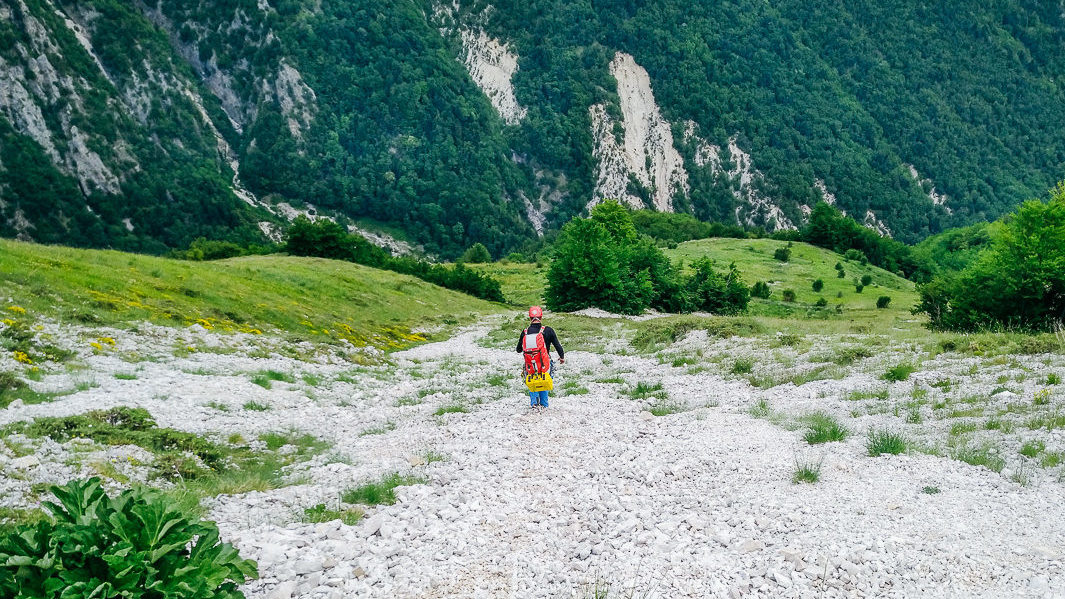
We entered at about 950m. Canyon has 4 vertical / abseiling sections. Highest / longest abseil is about 40 meters, so 2x 60m rope and safety rope should be more the enough. There is about 30 abseils. In between vertical sections there are long walking/bolder hopping sections that make day quite long (it took us 7 hours). Once the canyon opens up (at about 550m), you have to walk for another two kilometers to the village Zhepe. We used two anchorpoints, the rest was improvised using slings, stucked wood and other handy material. If you plan a repetition, make sure to bring powerdrill. We placed anchorponts at safe spots, but the water catchment area of the canyon is quite big, so they might be washed away. We made big mistake by not exploring the left bank of the canyon. Olo lately stated that there are paths that would make the approach less demanding. Using drone to scout for the trail could be really handy.
And the final question: would we do it again? Yes! But earlier in the spring when there is more flowing water. So the middle of May would be a good timing.
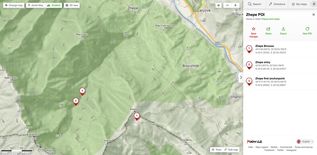
If anybody is interested in descending Zhepe our POI can be found here: https://en.mapy.cz/s/kocezadufe
Photo credits: Sandi Kmetič aka Canyon Dave
Zhepe canyon first descent